ロサンゼルス近郊を3Dで視覚化
🔥 山火事リスクを3Dで視覚化 🗺️
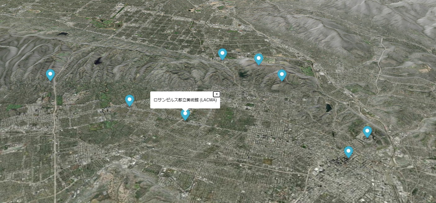
プロジェクト概要: このプロジェクトでは、ロサンゼルス近郊の地形を詳細に3D表示し、有名なランドマークの位置をマッピング。
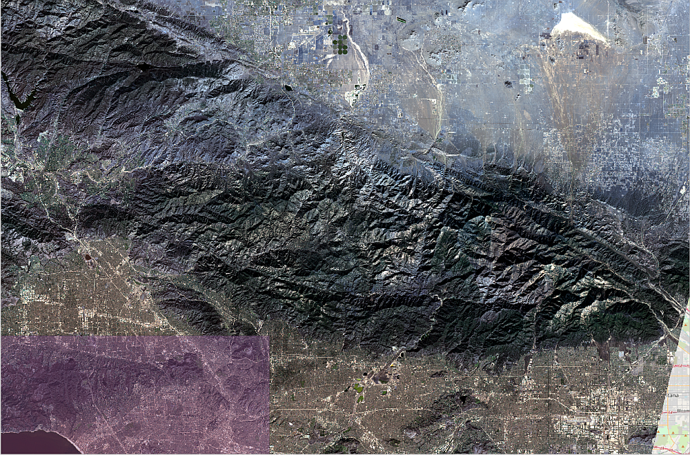
地形データを基にリアルな陰影を再現し、山火事のリスクや防災計画に役立つインタラクティブな地図を作成しました。
🖼️ インタラクティブ地図の表示
📊 使用データ
- 背景地図: 高解像度航空写真(Attribution: © Esri)
- 地形データ: AWS Terrain Tiles (Terrarium形式)、最大ズームレベル15
- ランドマークデータ: ロサンゼルスの人気スポットをJSON形式で作成(例: グリフィス天文台、ハリウッドサイン)
⚙️ 実現した機能
- 3D地形表示(MapLibre GL JSのterrainプロパティを使用)
- ヒルシェード表現のカスタマイズ(例: hillshade-exaggerationを0.4に設定)
- マーカーをクリックでスポット名をポップアップ表示
- 高解像度の背景地図をEsriの航空写真で再現
💡 想定される利用シーン
- 山火事リスク評価: 標高と地形の詳細を確認し、リスクの高いエリアを特定
- 防災計画: ランドマークを参考に避難経路やリソース配置を最適化
- 教育・研究用途: 地理学や地形学の教材として活用可能
- 都市計画: 地形データを基にインフラ設計やリスク管理を支援
🚀 技術詳細
開発環境: MapLibre GL JS 2.4.0
ソースデータ形式: GeoJSON, Raster DEM
実装のキーポイント:
- 背景地図をrasterソースで設定
- 地形データをraster-demで取得し、陰影を調整
- クリック可能なマーカーでランドマークをインタラクティブに表示
📌 ロサンゼルス周辺のランドマーク例
- グリフィス天文台(34.1184, -118.3004)
- ハリウッドサイン(34.1341, -118.3215)
- サンタモニカピア(34.0092, -118.4953)
実装サンプルコード
const mapSettings = {
  hillshade: {
    exaggeration: 0.4,
    highlightColor: '#ffffff',
    shadowColor: '#666666',
    accentColor: '#cccccc',
  }
};

const map = new maplibregl.Map({
  container: 'map',
  style: {
    version: 8,
    sources: {
      "esri-imagery": {
        type: "raster",
        tiles: [
          'https://services.arcgisonline.com/ArcGIS/rest/services/World_Imagery/MapServer/tile/{z}/{y}/{x}'
        ],
        tileSize: 256,
        attribution: "© Esri"
      },
      "aws-terrain": {
        type: "raster-dem",
        tiles: [
          "https://s3.amazonaws.com/elevation-tiles-prod/terrarium/{z}/{x}/{y}.png"
        ],
        encoding: "terrarium",
        tileSize: 256,
        maxzoom: 15,
        attribution: `ArcticDEM terrain data; other terrain data © respective owners.`
      }
    },
    layers: [
      {
        id: "esri-imagery",
        type: "raster",
        source: "esri-imagery"
      },
      {
        id: "hills",
        type: "hillshade",
        source: "aws-terrain",
        paint: {
          "hillshade-exaggeration": mapSettings.hillshade.exaggeration,
          "hillshade-highlight-color": mapSettings.hillshade.highlightColor,
          "hillshade-shadow-color": mapSettings.hillshade.shadowColor,
          "hillshade-accent-color": mapSettings.hillshade.accentColor
        }
      }
    ],
    terrain: {
      source: "aws-terrain",
      exaggeration: 1.2
    }
  },
  center: [-118.3, 34.1],
  zoom: 10
});

const locations = [
  { "name": "グリフィス天文台", "lat": 34.1184, "lon": -118.3004 },
  { "name": "ハリウッドサイン", "lat": 34.1341, "lon": -118.3215 },
  { "name": "サンタモニカピア", "lat": 34.0092, "lon": -118.4953 },
  { "name": "ゲティセンター", "lat": 34.078, "lon": -118.4741 },
  { "name": "ロサンゼルス郡立美術館 (LACMA)", "lat": 34.0638, "lon": -118.3579 }
];

map.on('load', () => {
  locations.forEach(location => {
    const popup = new maplibregl.Popup({ offset: 25 }).setText(location.name);
    new maplibregl.Marker()
      .setLngLat([location.lon, location.lat])
      .setPopup(popup)
      .addTo(map);
  });
});
#ロサンゼルス #山火事 #3D地形 #人工衛星画像 #災害情報 #避難指示 #ゲッティセンター #地図情報 #オープンストリートマップ #最新ニュース
コメント